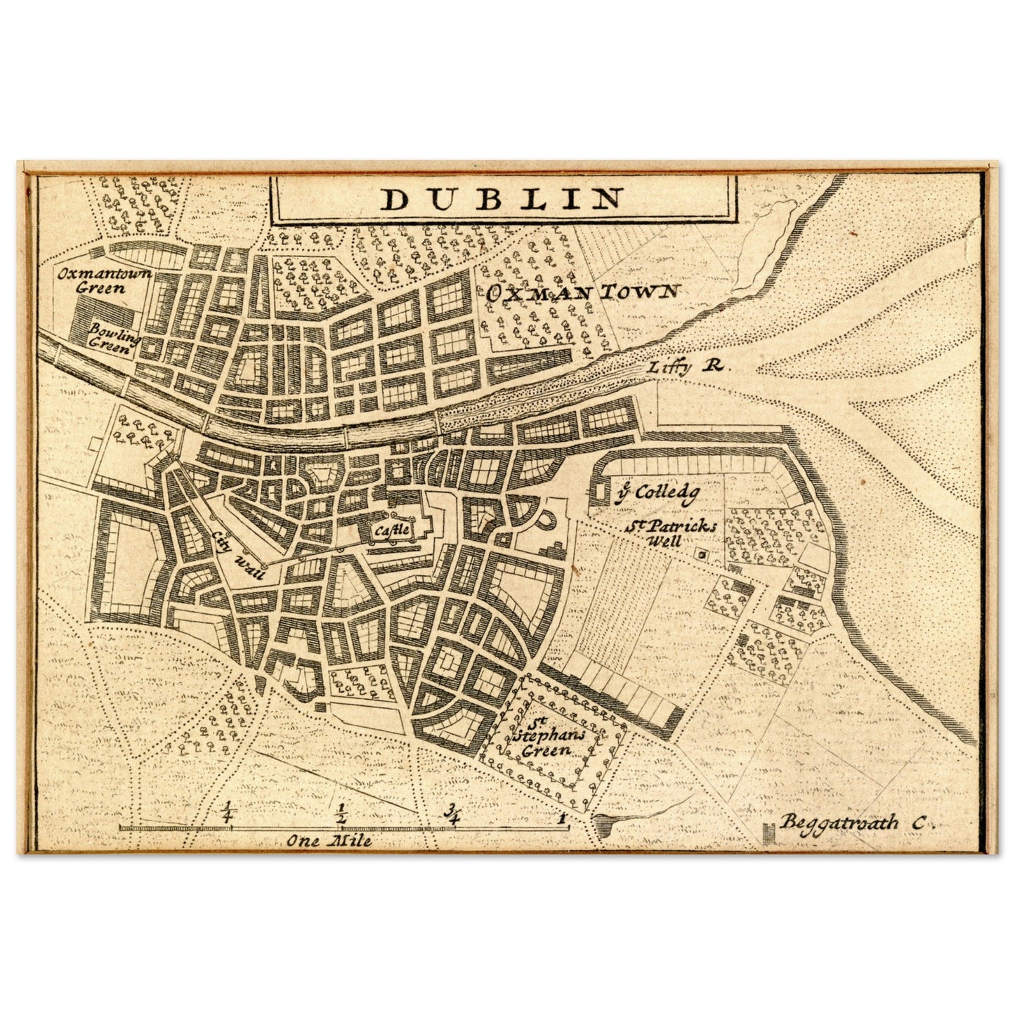
Map of Dublin City in 1714 by Herman Moll
Map of Dublin City in 1714 by Herman Moll
Couldn't load pickup availability
Step back in time and explore the rich history of Dublin with this meticulously crafted reproduction of Herman Moll’s 1714 map. Capturing the city as it stood over 300 years ago, this exquisite print transports you to a time when Dublin's iconic landmarks, such as Oxmantown on the north bank and Saint Stephen’s Green on the south, lined the River Liffey.
Originally part of Moll's renowned New Map of Ireland, this map is a must-have for history lovers, Dublin enthusiasts, and art collectors alike. Expertly reproduced from the National Gallery of Ireland's collection, it maintains all the intricate details and charm of the original.
Perfect for home decor or a unique gift, this print brings an element of Irish history into any space, whether you're celebrating your love for Dublin or adding a touch of old-world sophistication to your walls.
Why You'll Love This Print:
- Historical Authenticity: A faithful reproduction of Herman Moll's 1714 map, capturing Dublin’s history in stunning detail.
- Museum-Quality: Printed with care, ensuring vibrant colours and fine lines, this art piece mirrors the original map from the National Gallery of Ireland.
- A Timeless Addition: Ideal for framing, this piece will bring a sense of history, style, and sophistication to any room.
- Perfect Gift: Whether for history buffs, art enthusiasts, or Dublin lovers, this map makes a thoughtful and unique gift.
Transform your space with this captivating glimpse into Dublin's storied past – order your Map of Dublin City 1714 art print today!
National Gallery of Ireland Collection.
Share